![](/images/other/stat-length.png)
![Tocht Stappen La Orotava - Canaries - Tenerife - Ascension du Teide - Photo](https://media.geolcdn.com/t/1900/400/371681d7-a273-4bab-b36a-87206be53cab.jpg&format=pjpeg&maxdim=2)
Canaries - Tenerife - Ascension du Teide
fhascoet
Gebruiker
![Lengte](/images/other/stat-length.png)
![Max. hoogte](https://static1.geolcdn.com/siteimages/upload/files/1508320355ic_sort_altitude_max_24dp.png)
![Positief hoogteverschil](https://static1.geolcdn.com/siteimages/upload/files/1508320355ic_sort_den_pos_24dp.png)
![Km-Effort](/images/other/stat-length.png)
![Min. hoogte](https://static1.geolcdn.com/siteimages/upload/files/1508320355ic_sort_altitude_min_24dp.png)
![Negatief hoogteverschil](https://static1.geolcdn.com/siteimages/upload/files/1508320355ic_sort_den_neg_24dp.png)
![Boucle](https://static1.geolcdn.com/siteimages/upload/files/16400158638029165_repeat_loop_refresh_sync_direction_icon.png)
![Stappen](https://static1.geolcdn.com/sitytour/trail-icons/101.png)
11h19
Moeilijkheid : Zeer moeilijk
![Scan deze QR-code om de tocht te openen in de SityTrail-applicatie](https://capi.geolives.com/qq0zvz2zws4bq2lad0pu/sitytour/trails/2923455/qr.png?size=200)
Gratisgps-wandelapplicatie
Over ons
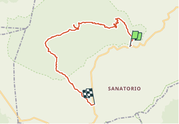
Tocht Stappen van 19,6 km beschikbaar op Canarische Eilanden, Santa Cruz de Tenerife, La Orotava. Deze tocht wordt voorgesteld door fhascoet.
Beschrijving
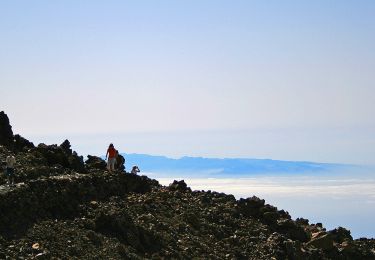
Départ de Montana Blanca (taxi) vers 7h du matin. Lever de soleil durant le début de la montée.
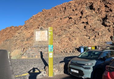
Début facile, sur une route en terre.
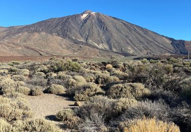
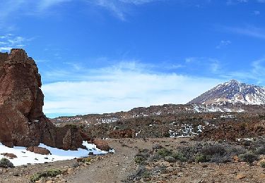
Puis montée raide sur le volcan jusqu'au refuge de Altavista à 3270m
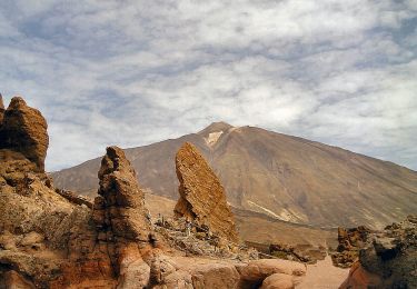
Après un repos bien mérité on continue à montée jusqu'a la station du téléphérique.
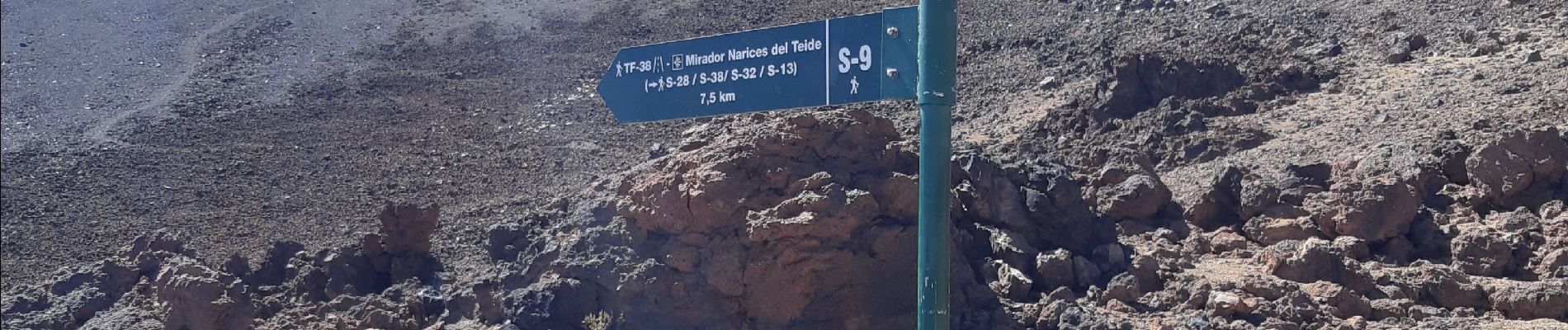
De là, si on a le passe pour monter, il reste 200m de dénivelé très raide à faire.
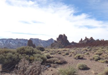
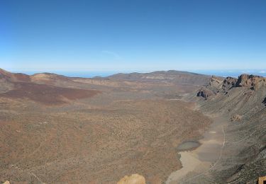
Redescente par le volcan Pico Viejo. Très beau paysage mais la marche dans la lave est assez éprouvante, surtout sur cette distance.
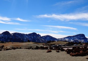
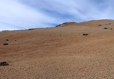
Arrivée à l'hotel Parador après avoir contourné un superbe massif en rocher orange "la cathedrale"
Temps donné avec le repas et les divers arrêts .
Plaatsbepaling
Opmerkingen
Wandeltochten in de omgeving
![Tocht Te voet La Orotava - Parador de Teide Alto Guajara caldeira de Teide - Photo](https://media.geolcdn.com/t/375/260/c8ab6db8-eb34-4747-a6d5-a22dfe02f5d8.jpg&format=jpg&maxdim=2)
![Te voet Te voet](https://static1.geolcdn.com/sitytour/trail-icons/100.png)
Te voet
![](/images/other/stat-length.png)
![](https://static1.geolcdn.com/siteimages/upload/files/16400158638029165_repeat_loop_refresh_sync_direction_icon.png)
![Tocht Stappen La Orotava - Montana Blanca Refuge Altavista Forteleza La Rambletta Teide 3718 m - Photo](https://media.geolcdn.com/t/375/260/382576d2-1cef-40f9-b6a1-573ec62ffcb6.jpg&format=jpg&maxdim=2)
![Stappen Stappen](https://static1.geolcdn.com/sitytour/trail-icons/101.png)
Stappen
![](/images/other/stat-length.png)
![](https://static1.geolcdn.com/siteimages/upload/files/16400158638029165_repeat_loop_refresh_sync_direction_icon.png)
![Tocht Te voet La Orotava - S-39 Teleférico-Montaña Blanca-Minas de San José - Photo](https://media.geolcdn.com/t/375/260/267b1c13-9372-42a6-8012-3981efb7d145.jpeg&format=jpg&maxdim=2)
![Te voet Te voet](https://static1.geolcdn.com/sitytour/trail-icons/100.png)
Te voet
![](/images/other/stat-length.png)
![](https://static1.geolcdn.com/siteimages/upload/files/16400158638029165_repeat_loop_refresh_sync_direction_icon.png)
![Tocht Te voet La Orotava - S-19 Majúa - Photo](https://media.geolcdn.com/t/375/260/d6a20f91-115e-4381-9aad-2d7b4fc7f0d0.jpeg&format=jpg&maxdim=2)
![Te voet Te voet](https://static1.geolcdn.com/sitytour/trail-icons/100.png)
Te voet
![](/images/other/stat-length.png)
![](https://static1.geolcdn.com/siteimages/upload/files/16400158638029165_repeat_loop_refresh_sync_direction_icon.png)
![Tocht Te voet La Orotava - S-30 Los Valles - Photo](https://media.geolcdn.com/t/375/260/281af76a-1e1a-4300-89ab-f6674754c3ad.jpeg&format=jpg&maxdim=2)
![Te voet Te voet](https://static1.geolcdn.com/sitytour/trail-icons/100.png)
Te voet
![](/images/other/stat-length.png)
![](https://static1.geolcdn.com/siteimages/upload/files/16400158638029165_repeat_loop_refresh_sync_direction_icon.png)
![Tocht Te voet La Orotava - S-16 Sanatorio - Photo](https://media.geolcdn.com/t/375/260/00ef7c7d-fee0-4fcc-a865-07fed4a262cd.jpeg&format=jpg&maxdim=2)
![Te voet Te voet](https://static1.geolcdn.com/sitytour/trail-icons/100.png)
Te voet
![](/images/other/stat-length.png)
![](https://static1.geolcdn.com/siteimages/upload/files/16400158638029165_repeat_loop_refresh_sync_direction_icon.png)
![Tocht Te voet La Orotava - S-9 Sendero Teide-Pico Viejo–Mirador de las Narices del Teide - Photo](https://media.geolcdn.com/t/375/260/14eb5da9-d94e-4348-a0b7-78e13331bd2b.jpeg&format=jpg&maxdim=2)
![Te voet Te voet](https://static1.geolcdn.com/sitytour/trail-icons/100.png)
Te voet
![](/images/other/stat-length.png)
![](https://static1.geolcdn.com/siteimages/upload/files/16400158638029165_repeat_loop_refresh_sync_direction_icon.png)
![Tocht Te voet La Orotava - S-7 Montaña Blanca-La Rambleta - Photo](https://media.geolcdn.com/t/375/260/2f181b8b-c0a2-49c0-9f60-b40365cab2be.jpeg&format=jpg&maxdim=2)
![Te voet Te voet](https://static1.geolcdn.com/sitytour/trail-icons/100.png)
Te voet
![](/images/other/stat-length.png)
![](https://static1.geolcdn.com/siteimages/upload/files/16400158638029165_repeat_loop_refresh_sync_direction_icon.png)
![Tocht Te voet Los Realejos - S-6 Montaña de Los Tomillos - Photo](https://media.geolcdn.com/t/375/260/f9cd0d8d-8278-4ad9-9ac9-301cd0450900.jpeg&format=jpg&maxdim=2)
![Te voet Te voet](https://static1.geolcdn.com/sitytour/trail-icons/100.png)
Te voet
![](/images/other/stat-length.png)
![](https://static1.geolcdn.com/siteimages/upload/files/16400158638029165_repeat_loop_refresh_sync_direction_icon.png)